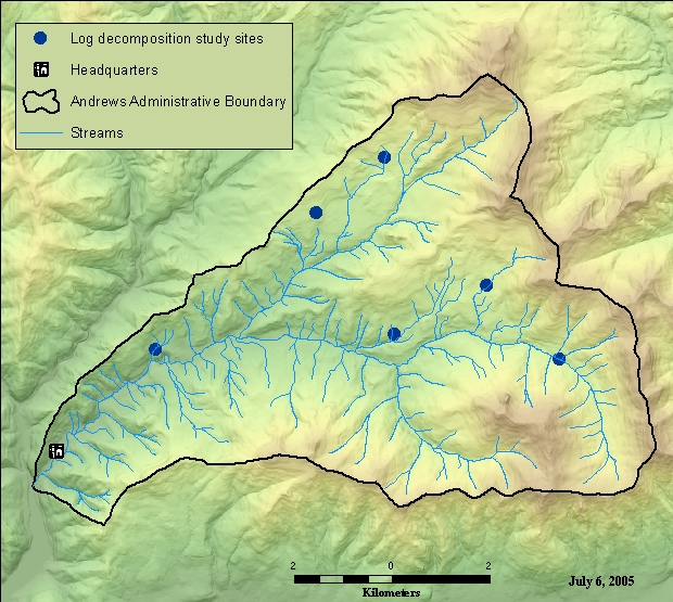
Log decomposition and nutrient release study site locations for 200 yr experiment, Andrews Experimental Forest
Metadata:
- Identification_Information:
-
- Citation:
-
- Citation_Information:
-
- Originator: Mark Harmon
- Publication_Date: 2002
- Title:
-
Log decomposition and nutrient release study site locations for 200 yr experiment, Andrews Experimental Forest
- Edition: 1
- Geospatial_Data_Presentation_Form: vector digital data
- Publication_Information:
-
- Publication_Place: Corvallis, OR
- Publisher: Forest Science Data Bank
- Other_Citation_Details:
-
/data/cascade/hja27/logsites
TD014
- Online_Linkage: <http://www.fsl.orst.edu/lter/data/spatialcatalog.cfm?topnav=160>
- Description:
-
- Abstract:
-
HJ Andrews log decompostition site locations for the 200 year log study that was started in 1985.
- Purpose:
-
This data was created to document the location of study sites for protection of these sites and for use with other data in the Forest Science Data Bank.
- Time_Period_of_Content:
-
- Time_Period_Information:
-
- Single_Date/Time:
-
- Calendar_Date: 1985
- Currentness_Reference: ground condition
- Status:
-
- Progress: Complete
- Maintenance_and_Update_Frequency: As needed
- Spatial_Domain:
-
- Bounding_Coordinates:
-
- West_Bounding_Coordinate: -122.228414
- East_Bounding_Coordinate: -122.124388
- North_Bounding_Coordinate: 44.266604
- South_Bounding_Coordinate: 44.228678
- Keywords:
-
- Theme:
-
- Theme_Keyword_Thesaurus: Andrews Forest LTER Thesaurus
- Theme_Keyword: biomass (woody debris)
- Theme_Keyword: terrestrial decomposition
- Theme_Keyword: permanent plots
- Theme_Keyword: long term study
- Theme_Keyword: forest floor
- Place:
-
- Place_Keyword: Oregon
- Place_Keyword: Willamette Basin
- Place_Keyword: Blue River Watershed
- Place_Keyword: HJ Andrews Experimental Forest
- Access_Constraints: Available on-line
- Use_Constraints:
-
See data access policy at www.fsl.orst.edu/lter/data.cfm (especially the data use policy)
- Point_of_Contact:
-
- Contact_Information:
-
- Contact_Person_Primary:
-
- Contact_Person: Theresa Valentine
- Contact_Organization: Corvallis Forest Science Laboratory
- Contact_Position: Spatial Information Manager
- Contact_Address:
-
- Address_Type: mailing and physical address
- Address: 3200 SW Jefferson Way
- City: Corvallis
- State_or_Province: Oregon
- Postal_Code: 97332
- Country: USA
- Contact_Voice_Telephone: 541-750-7333
- Contact_Facsimile_Telephone: 541-750-7760
- Contact_Electronic_Mail_Address: tvalentine@fs.fed.us or theresa.valentine@orst.edu
- Hours_of_Service: m-f 0800-1630
- Security_Information:
-
- Security_Classification: Unclassified
- Native_Data_Set_Environment:
-
Microsoft Windows 2000 Version 5.0 (Build 2195) Service Pack 4; ESRI ArcCatalog 9.0.0.535
- Cross_Reference:
-
- Citation_Information:
-
- Originator: Mark Harmon
- Publication_Date: 1991
- Publication_Time: Unknown
- Title:
-
Long-term experiments on log decomposition at the H.J. Andrews Experimental Forest. Gen. Tech. Rep. PNW-280
- Series_Information:
-
- Issue_Identification: Gen. Tech. Rep. PNW-280
- Publication_Information:
-
- Publication_Place: Portland, Oregon
- Publisher:
-
U.S. Department of Agriculture, Forest Service, Pacific Northwest Research Station.
- Data_Quality_Information:
-
- Logical_Consistency_Report: excellent (although not GPS locations)
- Lineage:
-
- Source_Information:
-
- Source_Scale_Denominator: 24000
- Type_of_Source_Media: paper
- Source_Time_Period_of_Content:
-
- Time_Period_Information:
-
- Single_Date/Time:
-
- Calendar_Date: 1993
- Source_Currentness_Reference: ground condition
- Process_Step:
-
- Process_Description: digitized in-house from base maps
- Process_Date: 09/08/1993
- Spatial_Data_Organization_Information:
-
- Direct_Spatial_Reference_Method: Vector
- Point_and_Vector_Object_Information:
-
- SDTS_Terms_Description:
-
- SDTS_Point_and_Vector_Object_Type: Entity point
- Point_and_Vector_Object_Count: 6
- SDTS_Terms_Description:
-
- SDTS_Point_and_Vector_Object_Type: Point
- Point_and_Vector_Object_Count: 18
- Spatial_Reference_Information:
-
- Horizontal_Coordinate_System_Definition:
-
- Planar:
-
- Grid_Coordinate_System:
-
- Grid_Coordinate_System_Name: Universal Transverse Mercator
- Universal_Transverse_Mercator:
-
- UTM_Zone_Number: 10
- Transverse_Mercator:
-
- Scale_Factor_at_Central_Meridian: 0.999600
- Longitude_of_Central_Meridian: -123.000000
- Latitude_of_Projection_Origin: 0.000000
- False_Easting: 500000.000000
- False_Northing: 0.000000
- Planar_Coordinate_Information:
-
- Planar_Coordinate_Encoding_Method: coordinate pair
- Coordinate_Representation:
-
- Abscissa_Resolution: 0.000005
- Ordinate_Resolution: 0.000005
- Planar_Distance_Units: meters
- Geodetic_Model:
-
- Horizontal_Datum_Name: North American Datum of 1927
- Ellipsoid_Name: Clarke 1866
- Semi-major_Axis: 6378206.400000
- Denominator_of_Flattening_Ratio: 294.978698
- Entity_and_Attribute_Information:
-
- Detailed_Description:
-
- Entity_Type:
-
- Entity_Type_Label: logsites.pat
- Entity_Type_Definition: logsites point attribute table
- Entity_Type_Definition_Source: FSL Documentation
- Attribute:
-
- Attribute_Label: FID
- Attribute_Definition: Internal feature number.
- Attribute_Definition_Source: ESRI
- Attribute_Domain_Values:
-
- Unrepresentable_Domain:
-
Sequential unique whole numbers that are automatically generated.
- Attribute:
-
- Attribute_Label: Shape
- Attribute_Definition: Feature geometry.
- Attribute_Definition_Source: ESRI
- Attribute_Domain_Values:
-
- Unrepresentable_Domain: Coordinates defining the features.
- Attribute:
-
- Attribute_Label: AREA
- Attribute_Definition: Area of feature in internal units squared.
- Attribute_Definition_Source: ESRI
- Attribute_Domain_Values:
-
- Unrepresentable_Domain:
-
Area is always zero for point coverages. Values are automatically generated.
- Attribute:
-
- Attribute_Label: PERIMETER
- Attribute_Definition: Perimeter of feature in internal units.
- Attribute_Definition_Source: ESRI
- Attribute_Domain_Values:
-
- Unrepresentable_Domain:
-
Perimeter is always zero for point coverages. Values are automatically generated.
- Attribute:
-
- Attribute_Label: LOGSITES#
- Attribute_Definition: Internal feature number.
- Attribute_Definition_Source: ESRI
- Attribute_Domain_Values:
-
- Unrepresentable_Domain:
-
Sequential unique whole numbers that are automatically generated.
- Attribute:
-
- Attribute_Label: LOGSITES-ID
- Attribute_Definition: User-defined feature number.
- Attribute_Definition_Source: ESRI
- Attribute:
-
- Attribute_Label: SITENAME
- Attribute_Definition: name of site
- Attribute_Definition_Source: FSL Documentation
- Attribute:
-
- Attribute_Label: INVESTIGATOR
- Attribute_Definition: primary investigator of the study
- Attribute_Definition_Source: FSL Documentation
- Attribute:
-
- Attribute_Label: STUDY
- Attribute_Definition: study name or description
- Attribute_Definition_Source: FSL Documentation
- Attribute:
-
- Attribute_Label: BGNDATE
- Attribute_Definition: beginning date of study or record
- Attribute_Definition_Source: FSL Documentation
- Attribute:
-
- Attribute_Label: ENDDATE
- Attribute_Definition: ending date of the study or record
- Attribute_Definition_Source: FSL Documentation
- Attribute:
-
- Attribute_Label: INSTRUMENT
- Attribute_Definition: type of instrumentation at the site
- Attribute_Definition_Source: FSL Documentation
- Attribute_Domain_Values:
-
- Enumerated_Domain:
-
- Enumerated_Domain_Value: T
- Enumerated_Domain_Value_Definition: thermograph
- Enumerated_Domain_Value_Definition_Source: FSL Documentation
- Enumerated_Domain:
-
- Enumerated_Domain_Value: M
- Enumerated_Domain_Value_Definition: meteorologic station
- Enumerated_Domain_Value_Definition_Source: FSL Documentation
- Enumerated_Domain:
-
- Enumerated_Domain_Value: R
- Enumerated_Domain_Value_Definition: rain gage
- Enumerated_Domain_Value_Definition_Source: FSL Documentation
- Enumerated_Domain:
-
- Enumerated_Domain_Value: G
- Enumerated_Domain_Value_Definition: stream gaging station
- Enumerated_Domain_Value_Definition_Source: FSL Documentation
- Attribute:
-
- Attribute_Label: ACTIVE
- Attribute_Definition: status of the study site
- Attribute_Definition_Source: FSL Documentation
- Distribution_Information:
-
- Distributor:
-
- Contact_Information:
-
- Contact_Person_Primary:
-
- Contact_Person: Theresa Valentine
- Contact_Organization: Corvallis Forest Science Laboratory
- Contact_Position: Spatial Information Manger
- Contact_Address:
-
- Address_Type: mailing and physical address
- Address: 3200 SW Jefferson Way
- City: Corvallis
- State_or_Province: OR
- Postal_Code: 97332
- Country: USA
- Contact_Voice_Telephone: 541-750-7333
- Contact_Facsimile_Telephone: 541-758-7760
- Contact_Electronic_Mail_Address: tvalentine@fs.fed.us or theresa.valentine@orst.edu
- Hours_of_Service: m-f 8:00am-4:30pm
- Resource_Description: Downloadable Data
- Distribution_Liability:
-
While substantial efforts are made to ensure the accuracy of data and documentation, complete accuracy of data sets cannot be guaranteed. All data are made available "as is". The Andrews LTER shall not be liable for damages resulting from any use or misinterpretation of data sets.
- Standard_Order_Process:
-
- Digital_Form:
-
- Digital_Transfer_Information:
-
- Format_Name: ARCE
- Transfer_Size: 0.122
- Fees: none
- Ordering_Instructions:
-
Obtain information off of WWW site, call contact person for special requests.
- Turnaround: as time permits
- Custom_Order_Process: Call contact person for instructions and costs.
- Metadata_Reference_Information:
-
- Metadata_Date: 20050706
- Metadata_Contact:
-
- Contact_Information:
-
- Contact_Person_Primary:
-
- Contact_Person: Theresa Valentine
- Contact_Organization: Corvallis Forest Science Laboratory
- Contact_Position: Spatial Information Manager
- Contact_Address:
-
- Address_Type: mailing and physical address
- Address: 3200 SW Jefferson Way
- City: Corvallis
- State_or_Province: Oregon
- Postal_Code: 97332
- Country: USA
- Contact_Voice_Telephone: 541-750-7333
- Contact_Facsimile_Telephone: 541-758-7760
- Contact_Electronic_Mail_Address: tvalentine@fs.fed.us or theresa.valentine@orst.edu
- Hours_of_Service: m-f 8:00am-4:00pm
- Metadata_Standard_Name: FGDC Content Standards for Digital Geospatial Metadata
- Metadata_Standard_Version: FGDC-STD-001-1998
- Metadata_Time_Convention: local time
- Metadata_Security_Information:
-
- Metadata_Security_Classification: Unclassified
- Metadata_Extensions:
-
- Online_Linkage: <http://www.esri.com/metadata/esriprof80.html>
- Profile_Name: ESRI Metadata Profile
Generated by mp version 2.8.6 on Wed Jul 06 10:32:18 2005