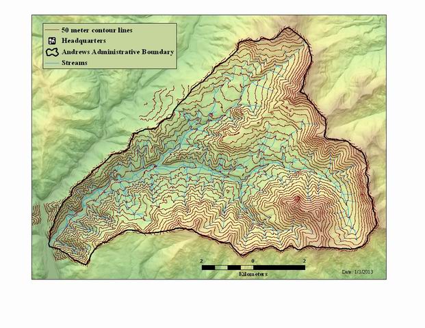
50 meter contour lines generated from a 10 meter DEM (from 2009 LiDAR Bare-earth DEM)
Shapefile

Tags
Blue River Watershed, Willamette Basin, Oregon, HJ Andrews Experimental Forest
The purpose of the 50 meter contour layer is to provide topographic relief and information on maps, images, and through analysis. The lines have been generalized to make a smoother, more visually appealing surface. This data will match up with the LiDAR generated stream and road layers, and the 1 meter DEMs.
The 50 meter contour lines were generated from a 10 meter digital elevation model (DEM) that was produced from the 1 meter Andrews Bare-earth DEM. The contour lines from the 1 meter DEM were too ragged to use for mapping purposes, hense the need to generalize the DEM out to 10 meters. The data is in an esri format shape file, and the contour lines are at 50 meter intervals. The value represents the number of meters above see level (elevation).
There are no credits for this item.
While substantial efforts are made to ensure the accuracy of data and documentation, complete accuracy of data sets cannot be guaranteed. All data are made available "as is". The Andrews LTER shall not be liable for damages resulting from any use or misinterpretation of data sets.
Extent
West -122.277246 East -122.099670 North 44.282806 South 44.196932
Maximum (zoomed in) 1:5,000 Minimum (zoomed out) 1:150,000,000