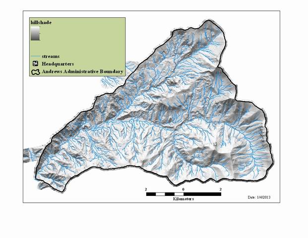
Hillshade grid generated from 2008 LiDAR 1 meter bare-earth DEM
Raster Dataset

Tags
topography, DEM, catography, LiDAR
The purpose of the hillshade is to provide topographic relief for maps, figures, and visualizations. The hillshade can also be used to capture features (roads, buildings, bridges), and to locate geological features such as landslides, stream channel characteristics, and earth movement. This data set is suitable for detailed work. Visualizations of the raw point clouds would be appropriate for those looking for sub-meter accuracy.
The hillshade was generated from the 1 meter bare-earth digital elevation model (DEM) based on the 2008 LiDAR flight over the Andrews Experimental Forest. The hillshade is at 1 meter resolution, and provides a detailed visualization of the forest with the vegetation removed. The hillshade command in spatial analyst was used with a sun azmuth of 345 degress and the altitude was set for 65 degrees.
There are no credits for this item.
There are no access and use limitations for this item.
Extent
West -122.277460 East -122.099580 North 44.282961 South 44.196797
Maximum (zoomed in) 1:5,000 Minimum (zoomed out) 1:50,000