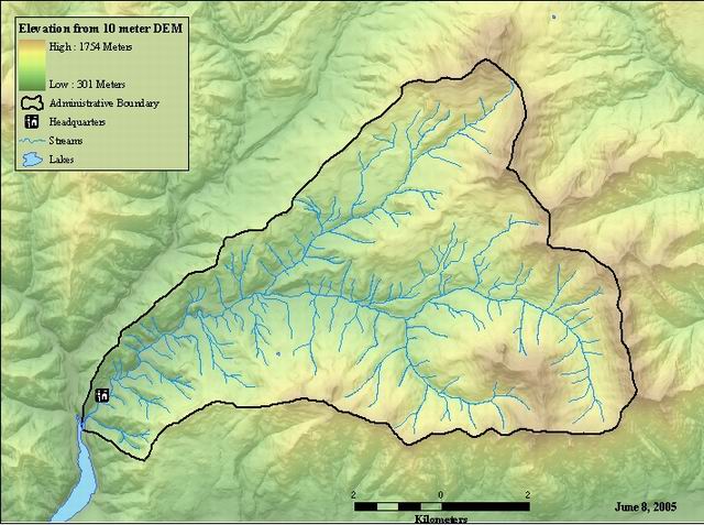
Lattice grid generated from 10 meter DEM for the HJ Andrews Experimental Forest
Raster Dataset

Tags
Blue River Watershed,
topography, HJ Andrews Experimental Forest, Oregon, DEM, Willamette Basin
DEMs are used to support a wide range of geographic information system (GIS) applications, including: surface hydrologic modeling, slope and aspect determination, viewshed analysis, fire modeling, contouring, transportation route planning, and profile generation. DEMs are also used to rectify aerial photography in the production of Digital Orthophoto Quads (DOQs)
10 Meter Digital Elevation Model (DEM) for the HJ Andrews Experimental Forest. A Digital Elevation Model (DEM) is a digital data file containing an array of elevation information over a portion of the earth's surface. This array is developed using information extracted from digitized elevation contours from PBS maps. A deatiled description of USGS DEMs can be found at http://rockyweb.cr.usgs.gov/elevation/dpi_dem.html as well as a users guide at ftp://mapping.usgs.gov/pub/ti/DEM/demguide/dugdem.txt.
There are no credits for this item.
While substantial efforts are made to ensure the accuracy of data and documentation, complete accuracy of data sets cannot be guaranteed. All data are made available "as is". The Andrews LTER shall not be liable for damages resulting from any use or misinterpretation of data sets.
Extent
West -122.377624 East -121.995783 North 44.377671 South 44.122378
Maximum (zoomed in) 1:5,000 Minimum (zoomed out) 1:150,000,000