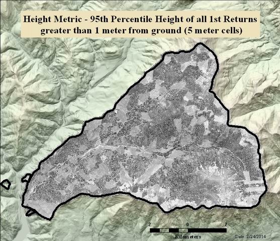
Height Metric - 95th Percentile Height of all 1st Returns greater than 1 meter from ground (5 meter cells)
Raster Dataset

Tags
HJ Andrews Experimental
Forest, Landscape Ecology, Oregon, geology, Blue River Watershed, Lidar, Willamette Basin,
Forest Metrics, Percentile Height
Percentile height is a forest metric derived from Lidar point clouds. This metric measures the height at which a given percent of the first return points are below. This analysis is done in a given grid cell size. Height metrics give various statistics of the elevation above ground for a given set of Lidar points. In forested landscapes, first return height metrics describe the forest canopy.
Percentile height is derived from the raw Lidar point clouds using the FUSION software. The horizontal resolution is 5 meters. Only first Lidar returns were used so that height metrics describe the top of the canopy. This metric measures the height at which 95% of the first return points are below. Lidar points below 1 meter from the ground were excluded from this analysis.
Watershed Sciences, Inc. (WS) collected Light Detection and Ranging (LiDAR) data from HJ Andrews and the Willamette National Forest (NF) on August 10th and 11th 2008. Total area for this AOI is 17,705 acres. The total area of delivered LiDAR including 100 m buffer is 19,493 acres.
There are no credits for this item.
See access and use constraints information.
Extent
West -122.277460 East -122.096288 North 44.295006 South 44.196772
Maximum (zoomed in) 1:5,000 Minimum (zoomed out) 1:50,000