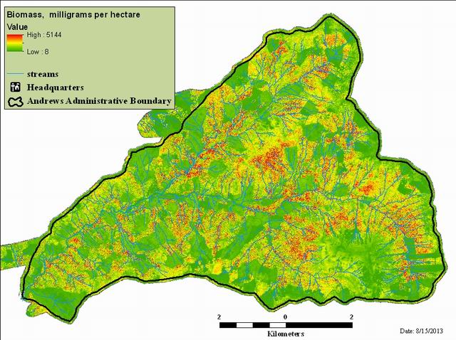
Aboveground Live Biomass (2008), Andrews Experimental Forest
Raster Dataset

Tags
HJ Andrews Experimental Forest, Landscape Ecology, Oregon, geology, Blue River Watershed, Lidar, Willamette Basin, Forest Metrics, Live Biomass
Live biomass is a forest metric derived from Lidar point clouds. This metric provides maps and images of aboveground live biomass for the HJ Andrews Experimental Forest. Live biomass can give a sense of how much vegetation exists on the landscape.
The biomass raster was developed by equations in (Seidl, et al 2012). Lidar variables used to create the raster include 95th percentile height, bare earth elevation, and the standard deviation of height in a 35m moving window.
Watershed Sciences, Inc. (WS) collected Light Detection and Ranging (LiDAR) data from HJ Andrews and the Willamette National Forest (NF) on August 10th and 11th 2008. Total area for this AOI is 17,705 acres. The total area of delivered LiDAR including 100 m buffer is 19,493 acres.
There are no credits for this item.
See access and use constraints information.
Extent
West -122.277460 East -122.096288 North 44.295006 South 44.196772
Maximum (zoomed in) 1:5,000 Minimum (zoomed out) 1:50,000