Surface features of rocks, roots, logs and vegetation, plot 6c3

Metadata:


Identification_Information:
Citation:
Citation_Information:
Originator: Robert Griffiths
Publication_Date: 7/2005
Title: Surface features of rocks, roots, logs and vegetation, plot 6c3
Edition: 1
Geospatial_Data_Presentation_Form: vector digital data
Publication_Information:
Publication_Place: Corvallis, OR
Publisher: Forest Science Data Bank
Other_Citation_Details:
FSDB Code SP030 \data\cascade\hja27\griffiths\top6c3
Online_Linkage: <http://www.fsl.orst.edu/lter/data/spatialcatalog.cfm?topnav=160>
Description:
Abstract:
Surface features of rocks, roots, logs and vegetation, plot 6c3. Ectomycorrhizal mats in forest soils have a wide global distribution and are apparently important to nutrient cycling. Since little known about the factors influencing their distribution we have conducted one of the first studies attempting to define the factors influencing mat distribution. We chose to study distribution patterns of mat-forming ectomycorrhizal fungi of the genera Hysterangium and Gautieria in coniferous forests of the Pacific northwestern United States by mapping ectomycorrhizal mats and other forest floor features in 2 x 10 meter plots and digitized into a Geographical Information System (GIS) for spatial pattern analysis. This data set represents the surface features of rocks, logs, and vegetation.

Duistribution was measured in terms of mat size, size variability and shape, total mat cover per stand age, nearest neighbor distances, and correlation with understory vegetation and tree age using the digitized plot mats. While GIS analysis indicated that Hysterangium and Gautieria did not physically overlap, there appears to be a tendency for clustering of mats. No apparent correlations were observed between forest floor features and mats located with the 2 x 10 meter grids. Mat distributions were found to vary temporally; total mat area, size and frequency differed for Hysterangium and Gautieria mapts when comparing young, mature and old-growth stands. The GIS analysis has been reported by Griffiths, et. Al (1996) and the digitized plot maps are now available on-line.

Purpose:
Preservation of species diversity has been identified as a critical measure of forest ecosystem health. The data collected on ectomycorrhizal mats suggests that their presence may be a key component for preserving species diversity and normal ecosystem function by providing host trees with requisite nutrients from mineral soil and soil organic matter.

Because of the potential importance of these mats (Cromack et al., 1988, Griffiths et al.,1991b, 1994), we wanted to determine which factors on a scale of a few meters influenced their distribution patterns. These factors included both surface features and mats of different species and function. We also wanted to determine the effects of stand age on mat distribution to better understand how forest harvesting might influence the occurance, size, shape and the physical relationships of mats.

Time_Period_of_Content:
Time_Period_Information:
Multiple_Dates/Times:
Single_Date/Time:
Calendar_Date: July 1992
Single_Date/Time:
Calendar_Date: July 1994
Single_Date/Time:
Calendar_Date: July 1998
Currentness_Reference: ground condition
Status:
Progress: Complete
Maintenance_and_Update_Frequency: None planned
Spatial_Domain:
Bounding_Coordinates:
West_Bounding_Coordinate: -122.234212
East_Bounding_Coordinate: -122.113073
North_Bounding_Coordinate: 44.249287
South_Bounding_Coordinate: 44.120829
Keywords:
Theme:
Theme_Keyword_Thesaurus: Andrews Forest LTER Thesaurus
Theme_Keyword: Long-Term Ecological Research
Theme_Keyword: plant/soil interactions
Theme_Keyword: ectomycorrhizal mat distribution
Theme_Keyword: GIS
Theme_Keyword: vegetation mapping
Place:
Place_Keyword: Oregon
Place_Keyword: Willamette Basin
Place_Keyword: Blue River Watershed
Place_Keyword: HJ Andrews Experimental Forest
Place_Keyword: Central Oregon Cascade Mountains
Place_Keyword: plot 6c3
Access_Constraints: Available on-line
Use_Constraints:
See data access policy at www.fsl.orst.edu/lter (especially the data use policy)
Point_of_Contact:
Contact_Information:
Contact_Person_Primary:
Contact_Person: Theresa Valentine
Contact_Organization: Corvallis Forest Science Laboratory
Contact_Position: Spatial Information Manager
Contact_Address:
Address_Type: mailing and physical address
Address: 3200 SW Jefferson Way
City: Corvallis
State_or_Province: Oregon
Postal_Code: 97332
Country: USA
Contact_Voice_Telephone: 541-750-7333
Contact_Facsimile_Telephone: 541-750-7760
Contact_Electronic_Mail_Address: tvalentine@fs.fed.us or theresa.valentine@orst.edu
Hours_of_Service: m-f 0800-1630
Security_Information:
Security_Classification: Unclassified
Native_Data_Set_Environment:
Microsoft Windows 2000 Version 5.0 (Build 2195) Service Pack 4; ESRI ArcCatalog 9.1.0.722
Cross_Reference:
Citation_Information:
Originator: Robert Griffiths
Publication_Date: 1996
Title:
Spatial distribution of ectomycorrhizal mats in coniferous forests of the Pacific Northwest, USA
Series_Information:
Issue_Identification: 180:147-158
Publication_Information:
Publisher: Plant and Soil
Other_Citation_Details: Plant and Soil 180:147-158.

Data_Quality_Information:
Logical_Consistency_Report: locations taken off of hard copy maps and digitized on-screen.
Positional_Accuracy:
Horizontal_Positional_Accuracy:
Horizontal_Positional_Accuracy_Report: locations taken off of hard copy maps and digitized on-screen.
Lineage:
Source_Information:
Type_of_Source_Media: paper
Process_Step:
Process_Description:
Study design:

Three sites of each age class were chosen on and near the H. J. Andrews Experimental Forest (HJA) located in the Central Oregon Cascade Mountains. Three plots were chosen at random in each of the three stands for a total of 27 plots. All age classes were Douglas-fir dominated forests in similar soils. The young stands were all 35-40 years old with similar plot preparation, subsequent seedling planting regimes and stand thinning schedules. The mature stands were the result of extensive natural fire events 90-125 years ago and the old-growth stands had trees that were over 400 years old.

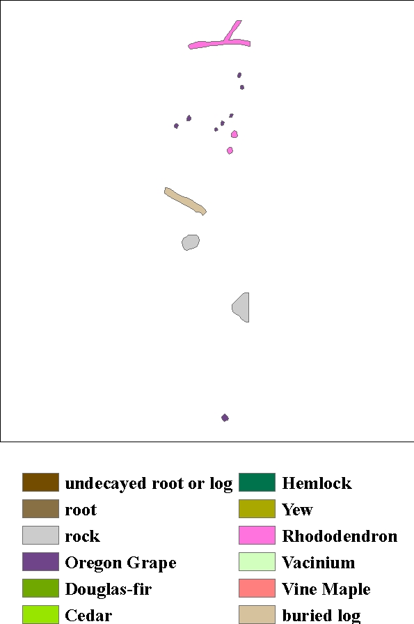
Three 2 x 10 meter plots were chosen at random at each of three sites of the same age class for the mat mapping study. These plots were flagged at 0.5 m intervals and raked to a depth of 5 cm. To-scale drawings of the type, size and location of all ectomycorrhizal mats, rocks, logs, stumps, and all nonherbacious plants were recorded on hand-drawn maps in the field using the grid as a guide. Two mat types (Hysterangium and Gautieria) were identified in the field by mat morphology. Gautieria-like mats were those that were restricted to the top portion of the mineral soil and were typically very dry, almost powdery in consistency and are associated with soils that have a bleached appearance (Griffiths et al. 1991a). Hysteragium-like mats were typified by relatively coarse white to cream rhizomorphs normally found in the litter and/or top of the mineral soil (Griffiths et al., 1991a). The location of neighboring dominant overstory trees was also noted. Twenty seven maps were made: 3 replicates from each location, 3 sites per age and 3 ages. These maps were used to generate digitized maps for the computer analyses.

The primary objective of this study was to determine which factors influence ectomycorrhizal mat distribution on a scale of a few cm to 10s of meters. Toward that end, we measured the influence of one mat on the presence of another, the influence of forest floor features on mat presence, and how the presence of potential host trees, stand density, and stand age influences mat distribution. The mapped mat data were digitized using GIS.

Process_Date: 11/21/1994
Process_Step:
Process_Description:
The primary objective of this study was to determine which factors influence ectomycorrhizal mat distribution on a scale of a few cm to 10s of meters. Toward that end, we measured the influence of one mat on the presence of another, the influence of forest floor features on mat presence, and how the presence of potential host trees, stand density, and stand age influences mat distribution. The mapped mat data were digitized using GIS. Separate digital maps were constructed of each mat species (i.e., Hysterangium and Gautieria) and of all other forest floor attributes within the plot (i.e., rocks, vegetation (vine maple, Pacific yew, and rhododendron), and coarse woody debris (stumps, surface logs and buried logs). All features were considered as potential contributors to mat patterns.
Process_Step:
Process_Description: Metadata imported.
Source_Used_Citation_Abbreviation: J:\hja27\griffiths\mat10y1\metadata.xml
Process_Step:
Process_Description: Metadata imported.
Source_Used_Citation_Abbreviation: J:\hja27\griffiths\top10y1\metadata.xml
Process_Step:
Process_Description: Metadata imported.
Source_Used_Citation_Abbreviation: J:\hja27\griffiths\top10y2\metadata.xml
Process_Step:
Process_Description: Metadata imported.
Source_Used_Citation_Abbreviation: J:\hja27\griffiths\top10y3\metadata.xml
Process_Step:
Process_Description: Metadata imported.
Source_Used_Citation_Abbreviation: J:\hja27\griffiths\top6y1\metadata.xml
Process_Step:
Process_Description: Metadata imported.
Source_Used_Citation_Abbreviation: J:\hja27\griffiths\top6c1\metadata.xml
Process_Step:
Process_Description: Metadata imported.
Source_Used_Citation_Abbreviation: J:\hja27\griffiths\top6c2\metadata.xml

Spatial_Data_Organization_Information:
Direct_Spatial_Reference_Method: Vector
Point_and_Vector_Object_Information:
SDTS_Terms_Description:
SDTS_Point_and_Vector_Object_Type: Complete chain
Point_and_Vector_Object_Count: 19
SDTS_Terms_Description:
SDTS_Point_and_Vector_Object_Type: Label point
Point_and_Vector_Object_Count: 14
SDTS_Terms_Description:
SDTS_Point_and_Vector_Object_Type: GT-polygon composed of chains
Point_and_Vector_Object_Count: 14
SDTS_Terms_Description:
SDTS_Point_and_Vector_Object_Type: Point
Point_and_Vector_Object_Count: 0

Spatial_Reference_Information:
Horizontal_Coordinate_System_Definition:
Planar:
Grid_Coordinate_System:
Grid_Coordinate_System_Name: Universal Transverse Mercator
Universal_Transverse_Mercator:
UTM_Zone_Number: 10
Transverse_Mercator:
Scale_Factor_at_Central_Meridian: 0.999600
Longitude_of_Central_Meridian: -123.000000
Latitude_of_Projection_Origin: 0.000000
False_Easting: 500000.000000
False_Northing: 0.000000
Planar_Coordinate_Information:
Planar_Coordinate_Encoding_Method: coordinate pair
Coordinate_Representation:
Abscissa_Resolution: 0.000032
Ordinate_Resolution: 0.000032
Planar_Distance_Units: meters
Geodetic_Model:
Horizontal_Datum_Name: North American Datum of 1927
Ellipsoid_Name: Clarke 1866
Semi-major_Axis: 6378206.400000
Denominator_of_Flattening_Ratio: 294.978698

Entity_and_Attribute_Information:
Detailed_Description:
Entity_Type:
Entity_Type_Label: top6c3.pat
Entity_Type_Definition: stand number 6. control (old growth) stand, plot number 3
Attribute:
Attribute_Label: FID
Attribute_Definition: Internal feature number.
Attribute_Definition_Source: ESRI
Attribute_Domain_Values:
Unrepresentable_Domain:
Sequential unique whole numbers that are automatically generated.
Attribute:
Attribute_Label: Shape
Attribute_Definition: Feature geometry.
Attribute_Definition_Source: ESRI
Attribute_Domain_Values:
Unrepresentable_Domain: Coordinates defining the features.
Attribute:
Attribute_Label: AREA
Attribute_Definition: Area of feature in internal units squared.
Attribute_Definition_Source: ESRI
Attribute_Domain_Values:
Unrepresentable_Domain: Positive real numbers that are automatically generated.
Attribute:
Attribute_Label: PERIMETER
Attribute_Definition: Perimeter of feature in internal units.
Attribute_Definition_Source: ESRI
Attribute_Domain_Values:
Unrepresentable_Domain: Positive real numbers that are automatically generated.
Attribute:
Attribute_Label: TOP6C3#
Attribute_Definition: Internal feature number.
Attribute_Definition_Source: ESRI
Attribute_Domain_Values:
Unrepresentable_Domain:
Sequential unique whole numbers that are automatically generated.
Attribute:
Attribute_Label: TOP6C3-ID
Attribute_Definition: User-defined feature number.
Attribute_Definition_Source: ESRI
Attribute:
Attribute_Label: TYPE
Attribute_Definition: surface featrue type
Attribute_Domain_Values:
Enumerated_Domain:
Enumerated_Domain_Value: 1
Enumerated_Domain_Value_Definition: undecayed root or log
Enumerated_Domain:
Enumerated_Domain_Value: 2
Enumerated_Domain_Value_Definition: root
Enumerated_Domain:
Enumerated_Domain_Value: 3
Enumerated_Domain_Value_Definition: rock
Enumerated_Domain:
Enumerated_Domain_Value: 4
Enumerated_Domain_Value_Definition: Oregon Grape
Enumerated_Domain:
Enumerated_Domain_Value: 5
Enumerated_Domain_Value_Definition: Douglas-fir
Enumerated_Domain:
Enumerated_Domain_Value: 6
Enumerated_Domain_Value_Definition: Cedar
Enumerated_Domain:
Enumerated_Domain_Value: 7
Enumerated_Domain_Value_Definition: Hemlock
Enumerated_Domain:
Enumerated_Domain_Value: 8
Enumerated_Domain_Value_Definition: Yew
Enumerated_Domain:
Enumerated_Domain_Value: 9
Enumerated_Domain_Value_Definition: Rhododendron
Enumerated_Domain:
Enumerated_Domain_Value: 10
Enumerated_Domain_Value_Definition: Vacinium
Enumerated_Domain:
Enumerated_Domain_Value: 11
Enumerated_Domain_Value_Definition: Vine Maple
Enumerated_Domain:
Enumerated_Domain_Value: 12
Enumerated_Domain_Value_Definition: buried log

Distribution_Information:
Distributor:
Contact_Information:
Contact_Person_Primary:
Contact_Person: Theresa Valentine
Contact_Organization: Corvallis Forest Science Laboratory
Contact_Position: Spatial Information Manger
Contact_Address:
Address_Type: mailing and physical address
Address: 3200 SW Jefferson Way
City: Corvallis
State_or_Province: OR
Postal_Code: 97332
Country: USA
Contact_Voice_Telephone: 541-750-7333
Contact_Facsimile_Telephone: 541-758-7760
Contact_Electronic_Mail_Address: tvalentine@fs.fed.us or theresa.valentine@orst.edu
Hours_of_Service: m-f 8:00am-4:30pm
Resource_Description: Downloadable Data
Distribution_Liability:
While substantial efforts are made to ensure the accuracy of data and documentation, complete accuracy of data sets cannot be guaranteed. All data are made available "as is". The Andrews LTER shall not be liable for damages resulting from any use or misinterpretation of data sets.
Standard_Order_Process:
Digital_Form:
Digital_Transfer_Information:
Format_Name: ARCE
Transfer_Size: 0.027
Digital_Transfer_Option:
Online_Option:
Computer_Contact_Information:
Network_Address:
Network_Resource_Name: T:\gis\oregon\willamette\hjandrews
Fees: none
Ordering_Instructions:
Obtain information off of WWW site, call contact person for special requests.
Turnaround: as time permits
Custom_Order_Process: Call contact person for instructions and costs.

Metadata_Reference_Information:
Metadata_Date: 20051123
Metadata_Contact:
Contact_Information:
Contact_Person_Primary:
Contact_Person: Theresa Valentine
Contact_Organization: Corvallis Forest Science Laboratory
Contact_Position: Spatial Information Manager
Contact_Address:
Address_Type: mailing and physical address
Address: 3200 SW Jefferson Way
City: Corvallis
State_or_Province: Oregon
Postal_Code: 97332
Country: USA
Contact_Voice_Telephone: 541-750-7333
Contact_Facsimile_Telephone: 541-758-7760
Contact_Electronic_Mail_Address: tvalentine@fs.fed.us or theresa.valentine@orst.edu
Hours_of_Service: m-f 8:00am-4:00pm
Metadata_Standard_Name: FGDC Content Standards for Digital Geospatial Metadata
Metadata_Standard_Version: FGDC-STD-001-1998
Metadata_Time_Convention: local time
Metadata_Security_Information:
Metadata_Security_Classification: Unclassified
Metadata_Extensions:
Online_Linkage: <http://www.esri.com/metadata/esriprof80.html>
Profile_Name: ESRI Metadata Profile

Generated by mp version 2.8.6 on Wed Nov 23 13:14:38 2005