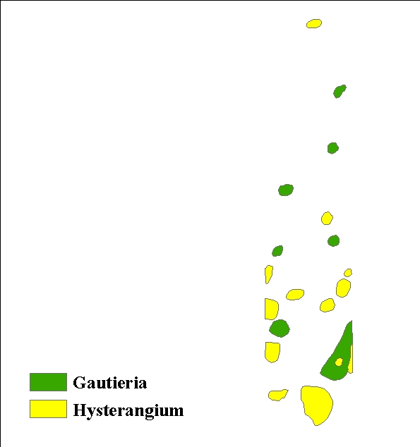
Duistribution was measured in terms of mat size, size variability and shape, total mat cover per stand age, nearest neighbor distances, and correlation with understory vegetation and tree age using the digitized plot mats. While GIS analysis indicated that Hysterangium and Gautieria did not physically overlap, there appears to be a tendency for clustering of mats. No apparent correlations were observed between forest floor features and mats located with the 2 x 10 meter grids. Mat distributions were found to vary temporally; total mat area, size and frequency differed for Hysterangium and Gautieria mapts when comparing young, mature and old-growth stands. The GIS analysis has been reported by Griffiths, et. Al (1996) and the digitized plot maps are now available on-line.
Because of the potential importance of these mats (Cromack et al., 1988, Griffiths et al.,1991b, 1994), we wanted to determine which factors on a scale of a few meters influenced their distribution patterns. These factors included both surface features and mats of different species and function. We also wanted to determine the effects of stand age on mat distribution to better understand how forest harvesting might influence the occurance, size, shape and the physical relationships of mats.
Three sites of each age class were chosen on and near the H. J. Andrews Experimental Forest (HJA) located in the Central Oregon Cascade Mountains. Three plots were chosen at random in each of the three stands for a total of 27 plots. All age classes were Douglas-fir dominated forests in similar soils. The young stands were all 35-40 years old with similar plot preparation, subsequent seedling planting regimes and stand thinning schedules. The mature stands were the result of extensive natural fire events 90-125 years ago and the old-growth stands had trees that were over 400 years old.
Three 2 x 10 meter plots were chosen at random at each of three sites of the same age class for the mat mapping study. These plots were flagged at 0.5 m intervals and raked to a depth of 5 cm. To-scale drawings of the type, size and location of all ectomycorrhizal mats, rocks, logs, stumps, and all nonherbacious plants were recorded on hand-drawn maps in the field using the grid as a guide. Two mat types (Hysterangium and Gautieria) were identified in the field by mat morphology. Gautieria-like mats were those that were restricted to the top portion of the mineral soil and were typically very dry, almost powdery in consistency and are associated with soils that have a bleached appearance (Griffiths et al. 1991a). Hysteragium-like mats were typified by relatively coarse white to cream rhizomorphs normally found in the litter and/or top of the mineral soil (Griffiths et al., 1991a). The location of neighboring dominant overstory trees was also noted. Twenty seven maps were made: 3 replicates from each location, 3 sites per age and 3 ages. These maps were used to generate digitized maps for the computer analyses.
The primary objective of this study was to determine which factors influence ectomycorrhizal mat distribution on a scale of a few cm to 10s of meters. Toward that end, we measured the influence of one mat on the presence of another, the influence of forest floor features on mat presence, and how the presence of potential host trees, stand density, and stand age influences mat distribution. The mapped mat data were digitized using GIS.