file geodatabase
Tags
Blue River Watershed,
Willamette Basin, Oregon, HJ Andrews Experimental Forest
To support research management within the HJ Andrews Experimental Forest and to document the status of roads in the general area (open, gated, abandoned). This data was developed to support the creation of the 2011 Andrews map.
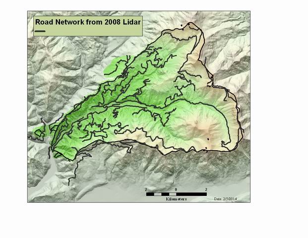
Andrews Road Network. This data contains road numbers, and status code for abandoned roads. The data was updated from the 2008 LiDAR bare earth DEM. The road network was digitzed on-screen from shaded relief versions of the DEM. The data was smoothed, road numbers identified, and annotation developed for mapping purposes
There are no credits for this item.
While substantial efforts are made to ensure the accuracy of data and documentation, complete accuracy of data sets cannot be guaranteed. All data are made available "as is". The Andrews LTER shall not be liable for damages resulting from any use or misinterpretation of data sets.
Extent
There is no extent for this
item.
Maximum (zoomed in) | 1:5,000 |
Minimum (zoomed out) | 1:150,000,000 |
LiDAR flight was completed in August 2008. See GI010 for informatin about the LiDAR flight.
Access constraints: Available on-line
Use constraints: See data access policy at www.fsl.orst.edu/lter (especially the data use policy)
While substantial efforts are made to ensure the accuracy of data and documentation, complete accuracy of data sets cannot be guaranteed. All data are made available "as is". The Andrews LTER shall not be liable for damages resulting from any use or misinterpretation of data sets.
Data was developed from 2008 LiDAR flight.
Obtain information off of WWW site, call contact person for special requests.
Call contact person for instructions and costs.
polyline
esri
Internal feature number.
ESRI
Feature geometry.
ESRI
Name/number of the road.
from Willamette NF maps and local knowledge
road type: abandoned or currently maintained.
local knowledge from forest manager
Length of feature in internal units.
ESRI
polyline
esri
Internal feature number.
ESRI
Feature geometry.
ESRI
For feature-linked annotation, contains the ObjectID of the linked feature. linked feature is in roads_sm.shp
esri
Unused at this time
esri
The annotation class the annotation belongs to
esri
BLOB field that stores symbology and text geometry
esri
The symbol in the symbol table
esri
Whether the feature is placed or unplaced
esri
The text string for the feature
esri
The name of the font, for example, Arial
esri
The size of the font in pixels
esri
Whether the text is bold—true/false
esri
Whether the text is italic—true/false
esri
Whether the text is underlined—true/false
esri
The vertical alignment of the text—top/center/baseline/bottom
esri
The horizontal alignment of the text—left/right/center/full
esri
Shifts the text position right or left
esri
Shifts the text position up or down
esri
Rotates the text angle
esri
Adjusts the spacing between lines
esri
Adjusts the spacing between words
esri
Adjusts the character width
esri
Adjusts the spacing between characters
esri
Adjusts the angle at which point rotated text is flipped in place
esri
The Override field is not editable and is maintained by ArcGIS. When the override value is 0, the annotation feature is displayed using the SymbolID text symbol that it references and no display properties are stored in the record. When the override value is greater than 0, the annotation feature uses the SymbolID text symbol as a base display and applies the overridden properties to that symbol. See the table below for a list of these possible values. The values that are seen in the attribute table are a sum of the values below. For example, if the override value is 65, then both the XOffset (1) and Size (64) properties are overridden (1+64=65).
esri
Length of feature in internal units.
ESRI
Area of feature in internal units squared.
Esri