Shapefile
Tags
contours, Blue River
Watershed, topography, HJ Andrews Experimental Forest, HJA, Oregon, DEM, Willamette Basin,
Willamette
To support research management within the HJ Andrews Experimental Forest
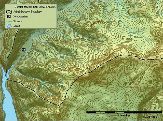
A 10-meter contour map of the HJ Andrews Experimental Forest (Oregon) created from the 30 meter DEM
There are no credits for this item.
While substantial efforts are made to ensure the accuracy of data and documentation, complete accuracy of data sets cannot be guaranteed. All data are made available "as is". The Andrews LTER shall not be liable for damages resulting from any use or misinterpretation of data sets.
Extent
West | -122.269400 | East | -122.096811 |
North | 44.286356 | South | 44.192762 |
Maximum (zoomed in) | 1:5,000 |
Minimum (zoomed out) | 1:150,000,000 |
publication date
Access constraints: Available on-line
Use constraints: See data access policy at www.fsl.orst.edu/lter/data.cfm (especially the data use policy)
While substantial efforts are made to ensure the accuracy of data and documentation, complete accuracy of data sets cannot be guaranteed. All data are made available "as is". The Andrews LTER shall not be liable for damages resulting from any use or misinterpretation of data sets.
Obtain information off of WWW site, call contact person for special requests.
Call contact person for instructions and costs.
contour elevation values in meters (referenced as positive about sea level)
FSL metadata document
Internal feature number.
ESRI
Feature geometry.
ESRI
from node: internal code that references the flow direction of the line
FSL metadata document
to node: internal code that references the flow direction of the line
FSL metadata document
Length of feature in internal units. (meters)
ESRI
computer generated unique identification number
FSL metadata document
user defined unique number
FSL metadata document
contour line value in meters
FSL metadata document
integer contour line value - meters
fsl metadata document
A 10-meter contour map of the HJ Andrews Experimental Forest (Oregon) created from the 30 meter DEM
To support research management within the HJ Andrews Experimental Forest
publication date
Available on-line
See data access policy at www.fsl.orst.edu/lter/data.cfm (especially the data use policy)
layer was derived from a 30-m DEM using the LATTICECONTOUR command
Dataset copied.
Dataset copied.
While substantial efforts are made to ensure the accuracy of data and documentation, complete accuracy of data sets cannot be guaranteed. All data are made available "as is". The Andrews LTER shall not be liable for damages resulting from any use or misinterpretation of data sets.
Obtain information off of WWW site, call contact person for special requests.