Edited copy of sample site locations obtained from Peter Weisberg (used for his 1998 publication),as documented by Giglia

Shapefile
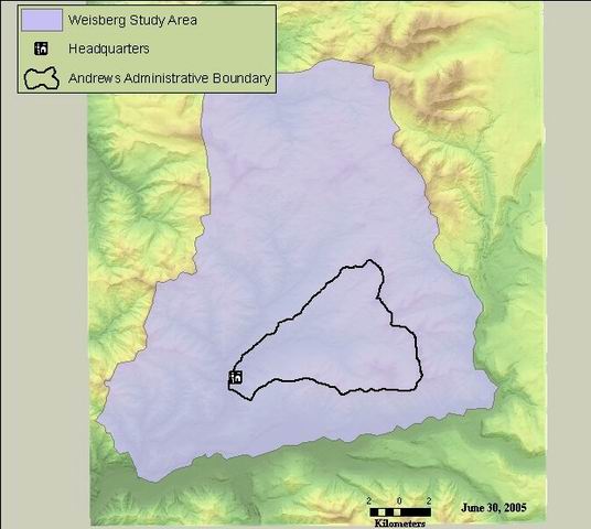
Thumbnail

Tags
old growth, western Cascades, super-old growth, central western Cascades, Oregon, HJ Andrews Experimental Forest, Douglas-fir, fire history


Summary

To provide a permanent, digital record of site locations and attributes for spatial and temporal analysis of fire history in the central western Cascades.

Description

This is an edited copy of shapefile "blue.shp" obtained from Peter Weisberg (used for his 1998 publication).

Credits

Weisberg, Giglia

Use limitations

While substantial efforts are made to ensure the accuracy of data and documentation, complete accuracy of data sets cannot be guaranteed. All data are made available "as is". The Andrews LTER shall not be liable for damages resulting from any use or misinterpretation of data sets.

Extent

West  -122.355921    East  -122.053102
North  44.393901    South  44.163653

Scale Range
Maximum (zoomed in)  1:5,000
Minimum (zoomed out)  1:150,000,000

ArcGIS Metadata 

Topics and Keywords 

*Content type  Downloadable Data


Place keywords  western Cascades, central western Cascades, Oregon, HJ Andrews Experimental Forest

Theme keywords  old growth, super-old growth, Douglas-fir, fire history

Thesaurus
Title Andrews Forest LTER Thesaurus


Citation 

Title Edited copy of sample site locations obtained from Peter Weisberg (used for his 1998 publication),as documented by Giglia
Publication date 1998-01-01 00:00:00


Edition 1


Presentation formats  digital map


Other citation details df02018 weisberg_allsites.shp


Citation Contacts 

Responsible party
Organization's name Peter Weisberg, Sherry Giglia
Contact's role  originator


Responsible party
Organization's name Forest Science Data Bank
Contact's role  publisher


Contact information
Address
Delivery point Corvallis, OR


Resource Details 

Dataset languages  English (UNITED STATES)


Status  completed
Spatial representation type  vector


*Processing environment Microsoft Windows 7 Version 6.1 (Build 7601) Service Pack 1; Esri ArcGIS 10.1.1.3143


Credits
Weisberg, Giglia
ArcGIS item properties
*Name weisberg_allsites
*Size 0.004
*Location file://\\quercus\fordata\oregon\willamette\hja83\giglia\weisberg_allsites.shp
*Access protocol Local Area Network

Extents 

Extent
Description
ground condition
Geographic extent
Bounding rectangle
Extent type  Extent used for searching
*West longitude -122.355921
*East longitude -122.053102
*North latitude 44.393901
*South latitude 44.163653
*Extent contains the resource Yes

Temporal extent
Date and time 1998-01-01 00:00:00

Extent in the item's coordinate system
*West longitude 551494.569074
*East longitude 575415.422969
*South latitude 4890482.184099
*North latitude 4915827.295684
*Extent contains the resource Yes

Resource Points of Contact 

Point of contact
Individual's name Theresa Valentine
Organization's name Corvallis Forest Science Laboratory
Contact's position Spatial Information Manager
Contact's role  point of contact


Contact information
Phone
Voice 541-750-7333
Fax 541-750-7760

Address
Type both
Delivery point 3200 SW Jefferson Way
City Corvallis
Administrative area Oregon
Postal code 97331
Country US
e-mail addresstvalentine@fs.fed.us or theresa.valentine@orst.edu

Hours of service m-f 0800-1630


Resource Maintenance 

Resource maintenance
Update frequency  as needed


Resource Constraints 

Legal constraints
Access constraints  other restrictions


Other constraints
Access constraints: Available on-line
Legal constraints
Use constraints  other restrictions


Other constraints
Use constraints: See data access policy at www.fsl.orst.edu/lter (especially the data use policy)
Security constraints
Classification  unclassified


Constraints
Limitations of use
While substantial efforts are made to ensure the accuracy of data and documentation, complete accuracy of data sets cannot be guaranteed. All data are made available "as is". The Andrews LTER shall not be liable for damages resulting from any use or misinterpretation of data sets.

Spatial Reference 

ArcGIS coordinate system
*Type Projected
*Geographic coordinate reference GCS_North_American_1983
*Projection NAD_1983_UTM_Zone_10N
*Coordinate reference details
Projected coordinate system
Well-known identifier 26910
X origin -5120900
Y origin -9998100
XY scale 450445547.3910538
Z origin -100000
Z scale 10000
M origin -100000
M scale 10000
XY tolerance 0.001
Z tolerance 0.001
M tolerance 0.001
High precision true
Latest well-known identifier 26910
Well-known text PROJCS["NAD_1983_UTM_Zone_10N",GEOGCS["GCS_North_American_1983",DATUM["D_North_American_1983",SPHEROID["GRS_1980",6378137.0,298.257222101]],PRIMEM["Greenwich",0.0],UNIT["Degree",0.0174532925199433]],PROJECTION["Transverse_Mercator"],PARAMETER["False_Easting",500000.0],PARAMETER["False_Northing",0.0],PARAMETER["Central_Meridian",-123.0],PARAMETER["Scale_Factor",0.9996],PARAMETER["Latitude_Of_Origin",0.0],UNIT["Meter",1.0],AUTHORITY["EPSG",26910]]

Reference system identifier
Value 26910
*Codespace EPSG
*Version 7.11.2


Spatial Data Properties 

Vector
*Level of topology for this dataset  geometry only


Geometric objects
Feature class name weisberg_allsites
*Object type  point
*Object count 139


ArcGIS Feature Class Properties
Feature class name weisberg_allsites
*Feature type Simple
*Geometry type Point
*Has topology FALSE
*Feature count 139
*Spatial index TRUE
*Linear referencing FALSE


Data Quality 

Scope of quality information
Resource level  dataset


Data quality report - Conceptual consistency
Measure description GPS unit used to identify site locations. Spatial accuracy unknown.


Data quality report - Quantitative attribute accuracy
Measure description All fields in this shapefile and the data contained in them were created by Peter Weisberg for his 1998 publication (PhD dissertation), with the following exceptions: "Site_ID," "researcher" and "SOG". These 3 fields were added by Giglia, and are explained under "entity attribute."


Lineage 

Process step
When the process occurred 2011-06-14 00:00:00
Description projected from NAD27 to NAD83
Rationale to meet requirements of US Forest Service


Process contact
Individual's name Theresa Valentine
Organization's name Corvallis Forest Science Laboratory
Contact's position Spatial Information Manager
Contact's role  author


Contact information
Phone
Voice 541-750-7333
Fax 541-758-7760

Address
Type both
Delivery point 3200 SW Jefferson Way
City Corvallis
Administrative area Oregon
Postal code 97332
Country US
e-mail addresstvalentine@fs.fed.us or theresa.valentine@orst.edu

Hours of service m-f 8:00am-4:00pm


Source data
Description Shapefile contributed by Peter Weisberg via e-mail attachment.


Source citation
Title Fire History, Fire Regimes and Development of Forest Structure in the Central Western Oregon Cascades
Publication date 1998-01-01


Other citation details PhD dissertation, Oregon State University, Corvallis, OR


Responsible party
Organization's name Peter J. Weisberg
Contact's role  originator


Resource location online
Locationhttp://andrewsforest.oregonstate.edu/pubs/biblio/abstract.cfm?Catalog_id=1536&topnav=175
Access protocol pdl
Function performed  download


Source data
Source citation
Title Weisberg_treedata
Publication date 1998-01-01 00:00:00


Other citation details MS Excel file containing tree-level data for sample sites


Responsible party
Individual's name Peter J. Weisberg
Contact's role  originator


Geoprocessing history 

Process
Process name
Date 2011-06-14 14:30:18
Tool location C:\Program Files\ArcGIS\Desktop10.0\ArcToolbox\Toolboxes\Data Management Tools.tbx\Project
Command issued
Project J:\hja27\Giglia\weisberg_allsites.shp J:\hja83\giglia\weisberg_allsites.shp PROJCS['NAD_1983_UTM_Zone_10N',GEOGCS['GCS_North_American_1983',DATUM['D_North_American_1983',SPHEROID['GRS_1980',6378137.0,298.257222101]],PRIMEM['Greenwich',0.0],UNIT['Degree',0.0174532925199433]],PROJECTION['Transverse_Mercator'],PARAMETER['False_Easting',500000.0],PARAMETER['False_Northing',0.0],PARAMETER['Central_Meridian',-123.0],PARAMETER['Scale_Factor',0.9996],PARAMETER['Latitude_Of_Origin',0.0],UNIT['Meter',1.0]] NAD_1927_To_NAD_1983_NADCON PROJCS['NAD_1927_UTM_Zone_10N',GEOGCS['GCS_North_American_1927',DATUM['D_North_American_1927',SPHEROID['Clarke_1866',6378206.4,294.9786982]],PRIMEM['Greenwich',0.0],UNIT['Degree',0.0174532925199433]],PROJECTION['Transverse_Mercator'],PARAMETER['False_Easting',500000.0],PARAMETER['False_Northing',0.0],PARAMETER['Central_Meridian',-123.0],PARAMETER['Scale_Factor',0.9996],PARAMETER['Latitude_Of_Origin',0.0],UNIT['Meter',1.0]]
Include in lineage when exporting metadata No


Distribution 

Distributor
Contact information
Individual's name Theresa Valentine
Organization's name Corvallis Forest Science Laboratory
Contact's position Spatial Information Manger
Contact's role  distributor


Contact information
Phone
Voice 541-750-7333
Fax 541-758-7760

Address
Type both
Delivery point 3200 SW Jefferson Way
City Corvallis
Administrative area OR
Postal code 97332
Country US
e-mail addresstvalentine@fs.fed.us or theresa.valentine@orst.edu

Hours of service m-f 8:00am-4:30pm


Ordering process
Terms and fees none
Turnaround time as time permits
Instructions
Obtain information off of WWW site, call contact person for special requests.

Ordering process
Instructions
Call contact person for instructions and costs.


Distribution format
*Name Shapefile
Version ArcGIS 10.1


Transfer options
*Transfer size 0.004


Online source
Location  http://andrewsforest.oregonstate.edu/data/studies/spatialdata/df02018.zip
Access protocol zip file
Function performed  download

Fields 

Details for object weisberg_allsites 
*Type Feature Class
*Row count 139
Definition
shapefile attribute table
Definition source
esri


Field FID
 
*Alias FID
*Data type OID
*Width 4
*Precision 0
*Scale 0
*Field description
Internal feature number.
*Description source
ESRI
*Description of values Sequential unique whole numbers that are automatically generated.


Field Shape
 
*Alias Shape
*Data type Geometry
*Width 0
*Precision 0
*Scale 0
*Field description
Feature geometry.
*Description source
ESRI
*Description of values Coordinates defining the features.


Field AREA
 
*Alias AREA
*Data type Double
*Width 12
*Precision 11
*Scale 3
Field description
field left over from coverage dataset.  not applicable to point data.
Description source
esri
Description of values value has no meaning.


Field PERIMETER
 
*Alias PERIMETER
*Data type Double
*Width 12
*Precision 11
*Scale 3
Description source
esri
Field description
field left over from coverage dataset.  not applicable to point data.
Description of values value has no meaning


Field BLUESITES_
 
*Alias BLUESITES_
*Data type Double
*Width 11
*Precision 11
*Scale 0
Field description
computer generated unique number
Description source
esri
Description of values computer generated unique number


Field BLUESITES1
 
*Alias BLUESITES1
*Data type Double
*Width 11
*Precision 11
*Scale 0
Field description
Researcher-defined site ID
Description source
author
Description of values unique number


Field X_COORD
 
*Alias X_COORD
*Data type Double
*Width 12
*Precision 11
*Scale 3
Field description
UTM easting coordinate
Description source
author
Description of values Coordinate identifying feature location


Field Y_COORD
 
*Alias Y_COORD
*Data type Double
*Width 12
*Precision 11
*Scale 3
Field description
UTM northing coordinate
Description source
author
Description of values Coordinate identifying feature location


Accuracy information
Accuracy unknown


Field PSCARDENS
 
*Alias PSCARDENS
*Data type Single
*Width 8
*Precision 7
*Scale 2
Field description
unknown
Description source
author
Description of values value unknown


Field PROPLOW
 
*Alias PROPLOW
*Data type Single
*Width 8
*Precision 7
*Scale 2
Field description
unknown
Description source
author
Description of values value unknown


Field RECLENGTH
 
*Alias RECLENGTH
*Data type Integer
*Width 8
*Precision 8
*Scale 0
Field description
unknown
Description source
author
Description of values value unknown


Field MFIALL
 
*Alias MFIALL
*Data type Single
*Width 8
*Precision 7
*Scale 2
Field description
unknown
Description source
author
Description of values value unknown


Field WMPIALL
 
*Alias WMPIALL
*Data type Single
*Width 8
*Precision 7
*Scale 2
Field description
unknown
Description source
author
Description of values value unknown


Field CVALL
 
*Alias CVALL
*Data type Single
*Width 8
*Precision 7
*Scale 2
Field description
unknown
Description source
author
Description of values value unknown


Field MAXFIALL
 
*Alias MAXFIALL
*Data type Integer
*Width 8
*Precision 8
*Scale 0
Field description
unknown
Description source
author
Description of values value unknown


Field MFINLOW
 
*Alias MFINLOW
*Data type Single
*Width 8
*Precision 7
*Scale 2
Field description
unknown
Description source
author
Description of values value unknown


Field WMPINLOW
 
*Alias WMPINLOW
*Data type Single
*Width 8
*Precision 7
*Scale 2
Field description
unknown
Description source
author
Description of values value unknown


Field CVNLOW
 
*Alias CVNLOW
*Data type Single
*Width 8
*Precision 7
*Scale 2
Field description
unknown
Description source
author
Description of values value unknown


Field MAXNLOW
 
*Alias MAXNLOW
*Data type Integer
*Width 8
*Precision 8
*Scale 0
Field description
unknown
Description source
author
Description of values value unknown


Field SHBA
 
*Alias SHBA
*Data type Single
*Width 8
*Precision 7
*Scale 2
Field description
unknown
Description source
author
Description of values value unknown


Field TOTBA
 
*Alias TOTBA
*Data type Single
*Width 8
*Precision 7
*Scale 2
Field description
unknown
Description source
author
Description of values value unknown


Field PRANGE
 
*Alias PRANGE
*Data type Integer
*Width 8
*Precision 8
*Scale 0
Field description
unknown
Description source
author
Description of values unknown value


Field TOTMAX
 
*Alias TOTMAX
*Data type Integer
*Width 8
*Precision 8
*Scale 0
Field description
unknown
Description source
author
Description of values unknown value


Field TOTMEAN
 
*Alias TOTMEAN
*Data type Single
*Width 8
*Precision 7
*Scale 2
Field description
unknown
Description source
author
Description of values value unknown


Field LRGPDENS
 
*Alias LRGPDENS
*Data type Single
*Width 8
*Precision 7
*Scale 2
Field description
unknown
Description source
author
Description of values unknown value


Field RICHNESS
 
*Alias RICHNESS
*Data type SmallInteger
*Width 2
*Precision 2
*Scale 0
Field description
unknown
Description source
author
Description of values unknown value


Field ABPRBA
 
*Alias ABPRBA
*Data type Single
*Width 8
*Precision 7
*Scale 2
Field description
unknown
Description source
author
Description of values value unknown


Field CADEBA
 
*Alias CADEBA
*Data type Single
*Width 8
*Precision 7
*Scale 2
Field description
unknown
Description source
author
Description of values unknown value


Field BIGSNAG
 
*Alias BIGSNAG
*Data type Single
*Width 8
*Precision 7
*Scale 2
Field description
unknown
Description source
author
Description of values value unknown


Field SNAGBA
 
*Alias SNAGBA
*Data type Single
*Width 8
*Precision 7
*Scale 2
Field description
unknown
Description source
author
Description of values value unknown


Field NUMCO
 
*Alias NUMCO
*Data type Double
*Width 11
*Precision 11
*Scale 0
Field description
unknown
Description source
author
Description of values value unknown


Field COPERCEN
 
*Alias COPERCEN
*Data type Single
*Width 8
*Precision 7
*Scale 4
Field description
unknown
Description source
author
Description of values value unknown


Field SITE_ID
 
*Alias SITE_ID
*Data type String
*Width 8
*Precision 0
*Scale 0
Field description
site ID as used in Excel spreadsheet showing tree-level data (Weisberg_treedata)
Description source
author
Description of values ID code


Field RESEARCHER
 
*Alias RESEARCHER
*Data type String
*Width 4
*Precision 0
*Scale 0
Field description
code identifying researcher
Description source
author
List of values
Value W
Description Weisberg
Enumerated domain value definition source author


Field SOG
 
*Alias SOG
*Data type SmallInteger
*Width 4
*Precision 4
*Scale 0
Field description
presence/absence of SOG at sample site
Description source
author
List of values
Value 1
Description at least one SOG tree was recorded at this site
Enumerated domain value definition source author


Value 0
Description no SOG recorded at this site
Enumerated domain value definition source author


References 

Aggregate Information
Association type  cross reference


Aggregate resource name
Title Spatial and Temporal Patterns of "super-old" Douglas-fir trees of the central western Cascades, Oregon - implications for the interpretation of fire history
Publication date 2004-06-01 00:00:00


Other citation details MS Thesis Oregon State University Dept. of Geosciences June 2004


Responsible party
Organization's name Sherry Giglia, Julia A. Jones, Fred Swanson
Contact's role  originator


Resource location online
Locationhttp://andrewsforest.oregonstate.edu/pubs/biblio/abstract.cfm?Catalog_id=4093&topnav=175
Access protocol pdf file
Function performed  download


Metadata Details 

Metadata language English (UNITED STATES)
Metadata character set  utf8 - 8 bit UCS Transfer Format


Scope of the data described by the metadata  dataset
Scope name* dataset


*Last update 2013-12-02


ArcGIS metadata properties
Metadata format ArcGIS 1.0
Metadata style FGDC CSDGM Metadata
Standard or profile used to edit metadata FGDC


Created in ArcGIS for the item 2011-06-14 14:30:18
Last modified in ArcGIS for the item 2013-12-02 16:04:19


Automatic updates
Have been performed Yes
Last update 2013-12-02 15:50:42


Metadata Contacts 

Metadata contact
Individual's name Theresa Valentine
Organization's name Corvallis Forest Science Laboratory
Contact's position Spatial Information Manager
Contact's role  point of contact


Contact information
Phone
Voice 541-750-7333
Fax 541-758-7760

Address
Type both
Delivery point 3200 SW Jefferson Way
City Corvallis
Administrative area Oregon
Postal code 97332
Country US
e-mail addresstvalentine@fs.fed.us or theresa.valentine@orst.edu

Hours of service m-f 8:00am-4:00pm


Metadata Constraints 

Security constraints
Classification  unclassified


Thumbnail and Enclosures 

Thumbnail
Thumbnail type  JPG

Enclosure
Enclosure type  File
Description of enclosure original metadata
Original metadata document, which was translated yes
Source metadata format fgdc

FGDC Metadata (read-only) 

Identification 

Citation
Citation Information
OriginatorPeter Weisberg, Sherry Giglia
Publication Date1998
Title
weisberg_allsites
Edition1
Geospatial Data Presentation Formvector digital data
Publication Information
Publication PlaceCorvallis, OR
PublisherForest Science Data Bank
Online Linkagehttp://www.fsl.orst.edu/lter/data/spatialcatalog.cfm?topnav=160

Description
Abstract
This is an edited copy of shapefile "blue.shp" obtained from Peter Weisberg (used for his 1998 publication).
Purpose
To provide a permanent, digital record of site locations and attributes for spatial and temporal analysis of fire history in the central western Cascades.
Time Period of Content
Time Period Information
Single Date/Time
Calendar Date1998
Currentness Reference
ground condition
Status
ProgressComplete
Maintenance and Update FrequencyAs needed

Spatial Domain
Bounding Coordinates
West Bounding Coordinate-122.354744
East Bounding Coordinate-122.051931
North Bounding Coordinate44.394054
South Bounding Coordinate44.163802

Keywords
Theme
Theme Keywordold growth
Theme Keywordsuper-old growth
Theme KeywordDouglas-fir
Theme Keywordfire history

Place
Place KeywordOregon
Place KeywordHJ Andrews Experimental Forest
Place Keywordcentral western Cascades
Place Keywordwestern Cascades

Access Constraints
Available on-line
Use Constraints
See data access policy at www.fsl.orst.edu/lter (especially the data use policy)
Point of Contact
Contact Information
Contact Person Primary
Contact PersonTheresa Valentine
Contact OrganizationCorvallis Forest Science Laboratory
Contact PositionSpatial Information Manager
Contact Address
Address Typemailing and physical address
Address3200 SW Jefferson Way
CityCorvallis
State or ProvinceOregon
Postal Code97331
CountryUNITED STATES

Contact Voice Telephone541-750-7333
Contact Facsimile Telephone541-750-7760
Contact Electronic Mail Addresstvalentine@fs.fed.us or theresa.valentine@orst.edu
Hours of Servicem-f 0800-1630

Data Set Credit
Weisberg, Giglia
Security Information
Security ClassificationUnclassified

Native Data Set Environment
Microsoft Windows 2000 Version 5.0 (Build 2195) Service Pack 4; ESRI ArcCatalog 9.0.0.535
Cross Reference
Citation Information
OriginatorSherry Giglia, Julia A. Jones, Fred Swanson
Publication DateUnpublished Material
Title
Spatial and Temporal Patterns of "super-old" Douglas-fir trees of the central western Cascades, Oregon - implications for the interpretation of fire history
Other Citation Details
MS Thesis Oregon State University Dept. of Geosciences June 2004


Data Quality 

Attribute Accuracy
Attribute Accuracy Report
All fields in this shapefile and the data contained in them were created by Peter Weisberg for his 1998 publication (PhD dissertation), with the following exceptions:  "Site_ID,"  "researcher"  and "SOG".  These 3 fields were added by Giglia, and are explained under "entity attribute."
Logical Consistency Report
GPS unit used to identify site locations.  Spatial accuracy unknown.
Lineage
Source Information
Source Citation
Citation Information
OriginatorPeter J. Weisberg
Publication Date1998
Title
Fire History, Fire Regimes and Development of Forest Structure in the Central Western Oregon Cascades
Other Citation Details
PhD dissertation, Oregon State University, Corvallis, OR

Type of Source Mediaelectronic mail system
Source Time Period of Content
Time Period Information
Multiple Dates/Times
Single Date/Time
Calendar Dateunknown
Source Currentness Reference
ground condition
Source Citation Abbreviation
blue.shp
Source Contribution
Shapefile contributed by Peter Weisberg via e-mail attachment.
Source Information
Source Citation
Citation Information
OriginatorPeter J. Weisberg
Publication DateUnpublished Material
Title
Weisberg_treedata
Other Citation Details
MS Excel file containing tree-level data for sample sites

Process Step
Process Description
Metadata imported.
Source Used Citation Abbreviation
T:\GIS\oregon\willamette\hjandrews\meta_contact\contact.txt.xml


Process Step
Process Description
Dataset copied.
Source Used Citation Abbreviation
N:\Giglia_SOG\Weisberg\weisberg_allsites


Spatial Reference 

Horizontal Coordinate System Definition
Planar
Planar Coordinate Information
Planar Coordinate Encoding Methodcoordinate pair
Coordinate Representation
Abscissa Resolution0.000064
Ordinate Resolution0.000064
Planar Distance Unitsmeters

Geodetic Model
Horizontal Datum NameNorth American Datum of 1927
Ellipsoid NameClarke 1866
Semi-major Axis6378206.400000
Denominator of Flattening Ratio294.978698

Entities and Attributes 

Detailed Description
Entity Type
Entity Type Labelweisberg_allsites
Entity Type Definition
shapefile attribute table
Entity Type Definition Sourceesri

Attribute
Attribute LabelFID
Attribute Definition
Internal feature number.
Attribute Definition SourceESRI
Attribute Domain Values
Unrepresentable Domain
Sequential unique whole numbers that are automatically generated.

Attribute
Attribute LabelShape
Attribute Definition
Feature geometry.
Attribute Definition SourceESRI
Attribute Domain Values
Unrepresentable Domain
Coordinates defining the features.

Attribute
Attribute LabelAREA
Attribute Definition
field left over from coverage dataset. not applicable to point data.
Attribute Definition Sourceesri
Attribute Domain Values
Unrepresentable Domain
value has no meaning.

Attribute
Attribute LabelPERIMETER
Attribute Definition
field left over from coverage dataset. not applicable to point data.
Attribute Definition Sourceesri
Attribute Domain Values
Unrepresentable Domain
value has no meaning

Attribute
Attribute LabelBLUESITES_
Attribute Definition
computer generated unique number
Attribute Definition Sourceesri
Attribute Domain Values
Unrepresentable Domain
computer generated unique number

Attribute
Attribute LabelBLUESITES1
Attribute Definition
Researcher-defined site ID
Attribute Definition Sourceauthor
Attribute Domain Values
Unrepresentable Domain
unique number

Attribute
Attribute LabelX_COORD
Attribute Definition
UTM easting coordinate
Attribute Definition Sourceauthor
Attribute Domain Values
Unrepresentable Domain
Coordinate identifying feature location

Attribute
Attribute LabelY_COORD
Attribute Definition
UTM northing coordinate
Attribute Definition Sourceauthor
Attribute Domain Values
Unrepresentable Domain
Coordinate identifying feature location
Attribute Value Accuracy Information
Attribute Value Accuracyunknown

Attribute
Attribute LabelPSCARDENS
Attribute Definition
unknown
Attribute Definition Sourceauthor
Attribute Domain Values
Unrepresentable Domain
value unknown

Attribute
Attribute LabelPROPLOW
Attribute Definition
unknown
Attribute Definition Sourceauthor
Attribute Domain Values
Unrepresentable Domain
value unknown

Attribute
Attribute LabelRECLENGTH
Attribute Definition
unknown
Attribute Definition Sourceauthor
Attribute Domain Values
Unrepresentable Domain
value unknown

Attribute
Attribute LabelMFIALL
Attribute Definition
unknown
Attribute Definition Sourceauthor
Attribute Domain Values
Unrepresentable Domain
value unknown

Attribute
Attribute LabelWMPIALL
Attribute Definition
unknown
Attribute Definition Sourceauthor
Attribute Domain Values
Unrepresentable Domain
value unknown

Attribute
Attribute LabelCVALL
Attribute Definition
unknown
Attribute Definition Sourceauthor
Attribute Domain Values
Unrepresentable Domain
value unknown

Attribute
Attribute LabelMAXFIALL
Attribute Definition
unknown
Attribute Definition Sourceauthor
Attribute Domain Values
Unrepresentable Domain
value unknown

Attribute
Attribute LabelMFINLOW
Attribute Definition
unknown
Attribute Definition Sourceauthor
Attribute Domain Values
Unrepresentable Domain
value unknown

Attribute
Attribute LabelWMPINLOW
Attribute Definition
unknown
Attribute Definition Sourceauthor
Attribute Domain Values
Unrepresentable Domain
value unknown

Attribute
Attribute LabelCVNLOW
Attribute Definition
unknown
Attribute Definition Sourceauthor
Attribute Domain Values
Unrepresentable Domain
value unknown

Attribute
Attribute LabelMAXNLOW
Attribute Definition
unknown
Attribute Definition Sourceauthor
Attribute Domain Values
Unrepresentable Domain
value unknown

Attribute
Attribute LabelSHBA
Attribute Definition
unknown
Attribute Definition Sourceauthor
Attribute Domain Values
Unrepresentable Domain
value unknown

Attribute
Attribute LabelTOTBA
Attribute Definition
unknown
Attribute Definition Sourceauthor
Attribute Domain Values
Unrepresentable Domain
value unknown

Attribute
Attribute LabelPRANGE
Attribute Definition
unknown
Attribute Definition Sourceauthor
Attribute Domain Values
Unrepresentable Domain
unknown value

Attribute
Attribute LabelTOTMAX
Attribute Definition
unknown
Attribute Definition Sourceauthor
Attribute Domain Values
Unrepresentable Domain
unknown value

Attribute
Attribute LabelTOTMEAN
Attribute Definition
unknown
Attribute Definition Sourceauthor
Attribute Domain Values
Unrepresentable Domain
value unknown

Attribute
Attribute LabelLRGPDENS
Attribute Definition
unknown
Attribute Definition Sourceauthor
Attribute Domain Values
Unrepresentable Domain
unknown value

Attribute
Attribute LabelRICHNESS
Attribute Definition
unknown
Attribute Definition Sourceauthor
Attribute Domain Values
Unrepresentable Domain
unknown value

Attribute
Attribute LabelABPRBA
Attribute Definition
unknown
Attribute Definition Sourceauthor
Attribute Domain Values
Unrepresentable Domain
value unknown

Attribute
Attribute LabelCADEBA
Attribute Definition
unknown
Attribute Definition Sourceauthor
Attribute Domain Values
Unrepresentable Domain
unknown value

Attribute
Attribute LabelBIGSNAG
Attribute Definition
unknown
Attribute Definition Sourceauthor
Attribute Domain Values
Unrepresentable Domain
value unknown

Attribute
Attribute LabelSNAGBA
Attribute Definition
unknown
Attribute Definition Sourceauthor
Attribute Domain Values
Unrepresentable Domain
value unknown

Attribute
Attribute LabelNUMCO
Attribute Definition
unknown
Attribute Definition Sourceauthor
Attribute Domain Values
Unrepresentable Domain
value unknown

Attribute
Attribute LabelCOPERCEN
Attribute Definition
unknown
Attribute Definition Sourceauthor
Attribute Domain Values
Unrepresentable Domain
value unknown

Attribute
Attribute LabelSITE_ID
Attribute Definition
site ID as used in Excel spreadsheet showing tree-level data (Weisberg_treedata)
Attribute Definition Sourceauthor
Attribute Domain Values
Unrepresentable Domain
ID code

Attribute
Attribute LabelRESEARCHER
Attribute Definition
code identifying researcher
Attribute Definition Sourceauthor
Attribute Domain Values
Enumerated Domain
Enumerated Domain ValueW
Enumerated Domain Value Definition
Weisberg
Enumerated Domain Value Definition Source
author

Attribute
Attribute LabelSOG
Attribute Definition
presence/absence of SOG at sample site
Attribute Definition Sourceauthor
Attribute Domain Values
Enumerated Domain
Enumerated Domain Value1
Enumerated Domain Value Definition
at least one SOG tree was recorded at this site
Enumerated Domain Value Definition Source
author
Enumerated Domain
Enumerated Domain Value0
Enumerated Domain Value Definition
no SOG recorded at this site
Enumerated Domain Value Definition Source
author

Distribution Information 

Distributor
Contact Information
Contact Person Primary
Contact PersonTheresa Valentine
Contact OrganizationCorvallis Forest Science Laboratory
Contact PositionSpatial Information Manger
Contact Address
Address Typemailing and physical address
Address3200 SW Jefferson Way
CityCorvallis
State or ProvinceOR
Postal Code97332
CountryUNITED STATES

Contact Voice Telephone541-750-7333
Contact Facsimile Telephone541-758-7760
Contact Electronic Mail Addresstvalentine@fs.fed.us or theresa.valentine@orst.edu
Hours of Servicem-f 8:00am-4:30pm

Resource DescriptionDownloadable Data
Distribution Liability
While substantial efforts are made to ensure the accuracy of data and documentation, complete accuracy of data sets cannot be guaranteed. All data are made available "as is". The Andrews LTER shall not be liable for damages resulting from any use or misinterpretation of data sets.
Standard Order Process
Digital Form
Digital Transfer Information
Format NameARCE
Transfer Size0.004

Feesnone
Ordering Instructions
Obtain information off of WWW site, call contact person for special requests.
Turnaroundas time permits


Custom Order Process
Call contact person for instructions and costs.


Metadata Reference 

Metadata Date2005-06-30
Metadata Contact
Contact Information
Contact Person Primary
Contact PersonTheresa Valentine
Contact OrganizationCorvallis Forest Science Laboratory
Contact PositionSpatial Information Manager
Contact Address
Address Typemailing and physical address
Address3200 SW Jefferson Way
CityCorvallis
State or ProvinceOregon
Postal Code97332
CountryUNITED STATES

Contact Voice Telephone541-750-7333
Contact Facsimile Telephone541-758-7760
Contact Electronic Mail Addresstvalentine@fs.fed.us or theresa.valentine@orst.edu
Hours of Servicem-f 8:00am-4:00pm

Metadata Standard NameFGDC Content Standards for Digital Geospatial Metadata
Metadata Standard VersionFGDC-STD-001-1998
Metadata Time Conventionlocal time


Metadata Security Information
Metadata Security ClassificationUnclassified