Shapefile
Tags
Blue River, HJ Andrews, aspect,
Oregon, HJ Andrews Experimental Forest, Willamette Basin, Blue River Watershed, Willamette
National Forest
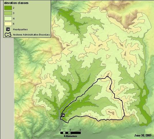
To provide a coarse scale elevation layer, used to classify landscape position of sample sites represented by points.
Shapefile created from reclassified grid with four elevation classes.
There are no credits for this item.
While substantial efforts are made to ensure the accuracy of data and documentation, complete accuracy of data sets cannot be guaranteed. All data are made available "as is". The Andrews LTER shall not be liable for damages resulting from any use or misinterpretation of data sets.
Extent
West | -122.333258 | East | -122.031347 |
North | 44.406321 | South | 44.191261 |
Maximum (zoomed in) | 1:5,000 |
Minimum (zoomed out) | 1:150,000,000 |
publication date
Access constraints: Available on-line
Use constraints: See data access policy at www.fsl.orst.edu/lter (especially the data use policy)
While substantial efforts are made to ensure the accuracy of data and documentation, complete accuracy of data sets cannot be guaranteed. All data are made available "as is". The Andrews LTER shall not be liable for damages resulting from any use or misinterpretation of data sets.
Obtain information off of WWW site, call contact person for special requests.
Call contact person for instructions and costs.
attribute table
author
Internal feature number.
ESRI
Feature geometry.
ESRI
could be unique number, not sure what the value here represents.
author
elevation class
author
area in square meters of sub-area polygon
author
perimeter of the sub-area polygon, in meters
author
acre value as calculaterd from area attribute field: value is in square meters
author
Shapefile created from reclassified grid with three elevation classes.
To provide a coarse scale elevation layer, used to classify landscape position of sample sites represented by points.
publication date
Available on-line
See data access policy at www.fsl.orst.edu/lter (especially the data use policy)
Polygons were manually drawn by digitizing on screen, tracing boundaries of ridges and river valleys, ignoring microtopography.
Metadata imported.
Reclassified 10m DEM into 4 elevation classes: 480-680m; 700-980m; 1000-1280m; and 1300-1540m. Converted to shapefile.
Metadata imported.
Dataset copied.
While substantial efforts are made to ensure the accuracy of data and documentation, complete accuracy of data sets cannot be guaranteed. All data are made available "as is". The Andrews LTER shall not be liable for damages resulting from any use or misinterpretation of data sets.
Obtain information off of WWW site, call contact person for special requests.